Digital Twin‑Driven Infrastructure | Smart City Planning & Asset Monitoring
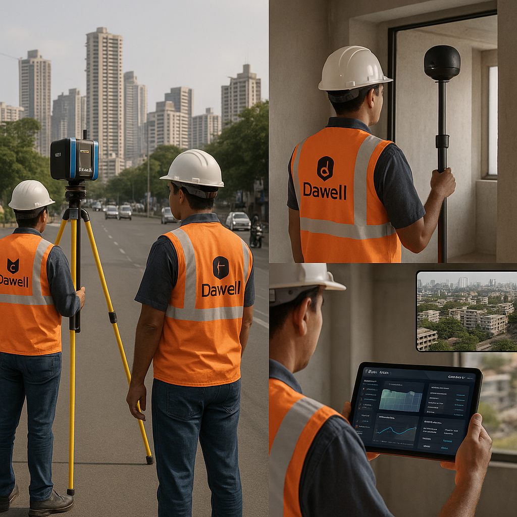
Dawell Lifescience provides cutting-edge tools—such as 3D laser scanning, drone integration, and ERP-enabled tracking to support departments like PWD, Revenue, Urban Planning, and Smart City agencies. Our systems facilitate real-time monitoring, data-driven decision-making, asset management, and public service transparency.

Digitize, Monitor, Secure, Manage.
Technology Deployed
- FARO 3D Laser Scanner
- FARO Blink
- Drone & Thermal Imaging Units
- ERP-based Infrastructure Monitoring Systems
- AI-enabled Analytics & Condition Prediction
- AI‑enabled Reporting & Dashboard Analytics
- GIS-integrated 3D Modelling Dashboards
TRUE TRACE
Integrated Infrastructure Monitoring & Digital Twin System
3D Mapping, Progress Documentation & Asset Health Analytics for Urban Governance
TRUE TRACE is Dawell’s 3D-based infrastructure monitoring platform designed for Urban Development Departments , Municipal Corporations , Smart City Missions , and PWD authorities . It enables real-time digital documentation of roads, bridges, buildings, and utilities using drone mapping, 3D scanning, and GIS-linked dashboards.
Key Capabilities
Scan roads, bridges, flyovers, or public assets with millimeter-accuracy models for visual inspections and progress logging.
Upload site photos, drone scans, and video logs with date/time/location metadata linked to project packages or zones.
AI engine flags cracks, deflections, material wear, or fire impact using historical scan comparisons.
Generate PDF + 3D-linked reports for RTI, Vigilance, Quality Control, and fund utilization transparency.
Centralized control for engineers, municipal planners, and state auditors to view real-time asset status with map overlays.
INFRA VIEW 360
Digital Infrastructure Condition Monitoring System for PWD & Urban Assets 3D Scanning | AI-Based Damage Detection | ERP-Linked Visual Reporting
INFRA VIEW 360 is Dawell’s advanced asset assessment solution tailored for Public Works Departments (PWD) , Urban Development Authorities , Municipal Corporations , and Smart City Projects . It leverages 3D laser scanning, drone mapping, and AI-enhanced analytics to inspect and document the condition of critical infrastructure such as roads, bridges, government buildings, and public utilities.
Capture high-precision scans of buildings, flyovers, culverts, and government assets for current condition records and virtual inspection.
System detects and flags surface cracks, material degradation, deflections, and alignment issues from scan data and drone imagery.
ERP interface shows live scan uploads, inspection summaries, and department-wise task status for engineers and auditors.
Compare initial scans with ongoing construction visuals to verify milestone completion or highlight deviations.
Generate inspection logs with officer ID, geotag, timestamp, and annotated visual evidence—compliant with technical audit or vigilance requirements.

LANDSIGHT
Digital Land Governance & Inspection ERP GIS-Linked Property Verification, Mutation Tracking & Field Inspection Workflow
LANDSIGHT is Dawell’s integrated land governance solution tailored for Revenue Departments , Urban Local Bodies , Municipal Corporations , and Survey & Settlement Offices . It combines mobile field inspection, 3D mapping, document verification, and GIS integration to provide a single, traceable, and tamper-proof land inspection and dispute resolution platform.
Field staff can document land parcels with photos, coordinates, owner ID, and timestamp using mobile apps.
DocEx tablet enables validation of 7/12 extracts, affidavits, and ownership claims in the field.
Integrates with satellite overlays or 3D scans to visualize property boundaries, encroachments, or land use zones.
Tracks case status, notes, and site visits in a digitally traceable format for faster resolution.
Automatically generates location-wise and case-wise reports for circle officers, tehsildars, and state HQ review.
Anvex AI SPEAK
Multilingual AI Voice Assistant for Government Communication & Automation Auto Calling | Voice-Based Workflow | Citizen Interaction Engine
ANVEX AI SPEAK is Dawell’s advanced voice-AI platform built to automate outbound and inbound communication for government departments , enforcement agencies , transport authorities , municipal bodies , and health institutions . It allows departments to initiate natural, human-like conversations with citizens, officers, or service users replacing manual calls, reminders, and helpline dependencies.
Send automated multilingual voice calls for traffic challans, utility bill recovery, MLC follow-ups, and compliance notices.
Deploy AI IVRs at police stations, hospitals, and municipal helplines to reduce wait times and route queries intelligently.
Use AI voice agents to spread awareness, send medicine reminders, or confirm patient check-ins across rural zones.
Run AI-driven campaigns for voter registration, citizen feedback, and social schemes backed by voice logs and OTP verification.
Create voice-based learning, recruitment simulations, or HR onboarding in departments like Police, Transport, and Revenue.
Impact Areas
Accurate Infrastructure Monitoring
Enable centralized oversight of urban development projects such as roads, drainage, and public assets in real-time—ideal for state-level scheme tracking.
Digital Civic Documentation
Generate city-scale digital twins for maintenance planning, urban planning decisions, and heritage site preservation with high-fidelity GIS and point cloud data.
Predictive Asset Management
Use AI analytics to simulate “what-if” scenarios for disaster resilience, urban flows, and thermal stress in areas prone to heat vulnerability or flooding.
Smart Citizen & Civic Feedback
Integrate digital twins with citizen engagement to enable participatory city maintenance and real-time public service feedback.